
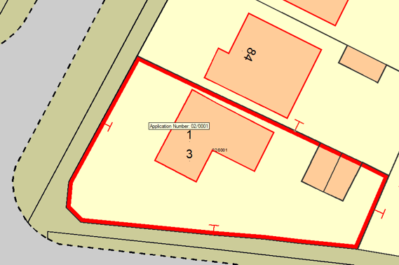
Select T Mark, you will see a T Mark symbol attached to the mouse pointer:

Use the mouse wheel to zoom in or pan the map to aid accuracy of placement.
Snap a position on the map for the leg of the T Mark. You will then see that as you move the mouse the T Mark rotates around this position. Snap a second position along the line of the boundary to orientate the symbol.
You can keep placing T Marks on boundaries until you press the Escape key.
To create a T Mark perpendicular to a boundary line place the T Mark on the line, rotate it to an approximately perpendicular position, and press the L key.
Ensure the Dataset Scale for the overlay with the T Marks is set to a suitable value, typically 500.
The concept of Scale in SISis fully explained What is scale?in the SISonline Help. For convenience an explanation of Dataset Scales can be seen by clicking here.
To allow T marks to be created on a database overlay carry out the following:
 1.gif)
 2.gif)
Click on Column > Create to display the New Field dialog:
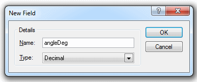
Enter angleDeg and press Return, the ANGLEDEG column will be added to the list in the Cursor Dataset Details dialog, as shown above.
Note: Make sure you select Decimal from the Type drop-down box in the New Field dialog.Click the More button in the Cursor Dataset Details dialog, the following dialog will be displayed, the AOracleSpatialCursorDts for Oracle or APostGisCursorDts for PostGIS dialog is displayed:
 3.gif)
Click Properties and and enter ANGLEDEG n the displayed Property/Value dialog:
 4.gif)
Click Close and dismiss the dialogs. SIS should now respect the angle of the T mark.
Send comments on this topic.
Click to return to www.cadcorp.com
© Copyright 2000-2017 Computer Aided Development Corporation Limited (Cadcorp).